
Hollywood ZIP Directory Coverage
An official City of Hollywood crosswalk identifies eight property ZIP areas touching the city. Five use familiar Hollywood postal geography, while three peripheral areas use codes usually linked with Fort Lauderdale or Davie. Two more codes appear in local PO-box use and should not be treated as residential polygons. The table keeps those roles distinct.
| ZIP Code | Areas Covered | Post Office | Notes |
|---|---|---|---|
| 33019 | North Beach, Hollywood Beach, Lakes and coastal areas | No station verified in inspected sources | Barrier-island zone; verify city limits |
| 33020 | Liberia, North Central, Parkside, Royal Poinciana, downtown | Hollywood Post Office | Historic east-central core |
| 33021 | Park East, Emerald Hills, Hollywood Hills, Hillcrest, Playland Estates | Hillcrest and Hollywood Hills stations | Also used by nearby municipalities |
| 33023 | Beverly Park, Lawn Acres, Washington Park | Central Carrier Annex | Shared southwest postal geography |
| 33024 | Driftwood, Boulevard Heights, West Hollywood area | No station verified | Extends beyond city limits |
| 33312 | Oakridge, Maple Ridge, Arapahoe Farms | No Hollywood station verified | Postal label may say Fort Lauderdale |
| 33314 | Northern State Road 7 corridor | No Hollywood station verified | Fragmented jurisdiction near Davie |
| 33316 | Hollywood portion of Port Everglades | No Hollywood station verified | Port and municipal layers overlap |
| 33022 / 33081 | No residential area verified | PO-box use | Do not map as neighborhoods |
Postal facilities listed here come from an official 2024 Census facility inventory created in 2026, not a USPS retail-services directory. Check USPS for current station services. The absence of a verified station name does not mean the ZIP lacks delivery service.
Hollywood ZIP Codes 33019 and 33020
The coast and original core sit in different kinds of geography. ZIP 33019 reaches North Beach, the barrier island, Hollywood Beach, Hollywood Lakes addresses, and other coastal communities. Bridges and the Intracoastal separate this area from the mainland, while the postal zone can include more than a simple beach label suggests.
ZIP 33020 covers downtown and neighborhoods such as Liberia, North Central, Parkside, Royal Poinciana, and the Central Business District. It contains Young Circle, City Hall, the Hollywood Branch Library, and much of the old street grid. Historic records may call Young Circle by its former name, Harding Circle, so test both when matching an old address.
Central and Western Hollywood ZIP Directory
ZIP 33021 spans Hollywood Hills, Emerald Hills, Hillcrest, Park East, Playland Estates, and the 441 corridor. It also appears on addresses in nearby West Park and Pembroke Park. A result in 33021 therefore needs a municipality or parcel check before it is labeled a Hollywood record.
Farther southwest, 33023 includes Beverly Park, Lawn Acres, and Washington Park while sharing postal geography with West Park and Miramar-area addresses. ZIP 33024 covers Driftwood, Boulevard Heights, and the city report's West Hollywood Group Area, but it too continues beyond Hollywood. These broad zones narrow a search. They do not finish it.
Physical landmarks can help test a result. Washington Park Community Center and its association mailing address both use 33023. Driftwood Community Center and Boulevard Heights Community Center anchor 33024 in city records. Such points show that a ZIP reaches a documented Hollywood neighborhood, but they still do not convert the full postal zone into city territory.
Hollywood Records in 33312 to 33316
Three codes show why mailing labels and city lines are different systems. Hollywood neighborhoods Oakridge, Maple Ridge, and Arapahoe Farms appear in 33312, although that ZIP is often associated with Fort Lauderdale. The city's northern State Road 7 corridor reaches 33314, amid Davie, tribal, county, and city jurisdictions.
Port Everglades creates the sharpest case. Part of the port is inside Hollywood, yet 33316 is strongly associated with Fort Lauderdale. City, county, port, federal, and special-district records may each describe the same area. Match the parcel, legal description, and agency jurisdiction before attaching a resident or property record to Hollywood.
Hollywood's PO-Box ZIP Exceptions
The Hollywood Housing Authority identifies 33022 as a PO-box ZIP with no associated properties. The city uses a 33022 mailing box even though City Hall's physical ZIP is 33020, and a North Beach association also uses the code. It belongs in a postal note, not a residential map.
Code 33081 appears in the city's neighborhood directory as a Hollywood Hills Civic Association PO box. No official evidence reviewed for this project places street-delivery properties inside it. Treat it as a specialized mailing code and verify any individual use through USPS.
The Hollywood Housing Authority ZIP map visually explains its multi-city service area and PO-box caveat.
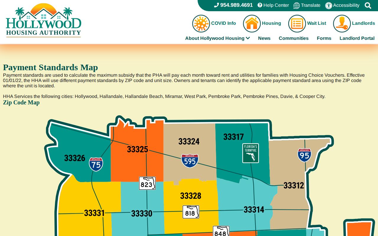
The authority serves several nearby municipalities, so its full list must not be mistaken for Hollywood city limits.
Search Hollywood Residents by ZIP Code
No inspected BCPA public search offered a dedicated one-click ZIP-wide field. A sound ZIP code directory workflow starts with postal and map tools, then moves to official parcel and record data. Broward GIS publishes ZIP boundaries, address points, municipal boundaries, and annexation history. BCPA searches by owner, street address, or folio, which is the parcel's property identification number.
- Enter the full delivery address in the USPS lookup and record the standardized result.
- Compare that point with Broward ZIP and municipal-boundary layers.
- Use the street address in BCPA, then save the folio, situs address, municipality, and legal description.
- If a lawful voter-data request fits the purpose, ask Broward Elections about available fields and geographic filtering.
- Move to street-level sources only after the ZIP and jurisdiction agree.
The Hollywood street directory covers the next stage once a ZIP narrows the area. Do not treat an individual voter-status lookup as a public roster. It requires identifying inputs and verifies one registration.
Florida voter-registration records have public fields, subject to exemptions and removal of Social Security, driver-license, state-ID, and protected-address data. Broward Elections handles data requests through separate routes for a general voter file and restricted vote-by-mail information. Ask the office what geography the current extract supports, what fees apply, and which fields will be withheld. Never infer that everyone in a ZIP is registered, still lives there, or appears in a public extract.
Verify a Hollywood ZIP with USPS
The USPS ZIP Code Lookup is the final source for a delivery code. It verifies postal routing, not incorporated-city jurisdiction.
| Lookup field | What to enter |
|---|---|
| Street address | House number and street name |
| Apt or suite | Unit when applicable |
| City and state | The mailing city and Florida |
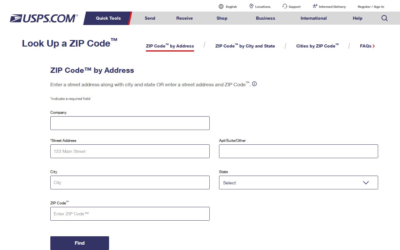
Copy the standardized address and ZIP+4 exactly. Then compare that result with Broward's municipal layer rather than assuming USPS has decided the city boundary.
Hollywood ZIP Boundaries and City Limits
ZIPs are delivery zones, while Hollywood's boundary reflects annexation and municipal law. Early city limits were unusually volatile. Hallandale and Dania joined boom-era Hollywood, then seceded after the 1926 hurricane, property collapse, and municipal bankruptcy. Modern Hollywood grew from one square mile to more than 28.87 square miles, and Port Everglades remains partly inside the city.
The City of Hollywood geography overview supplies the municipal scale and setting.
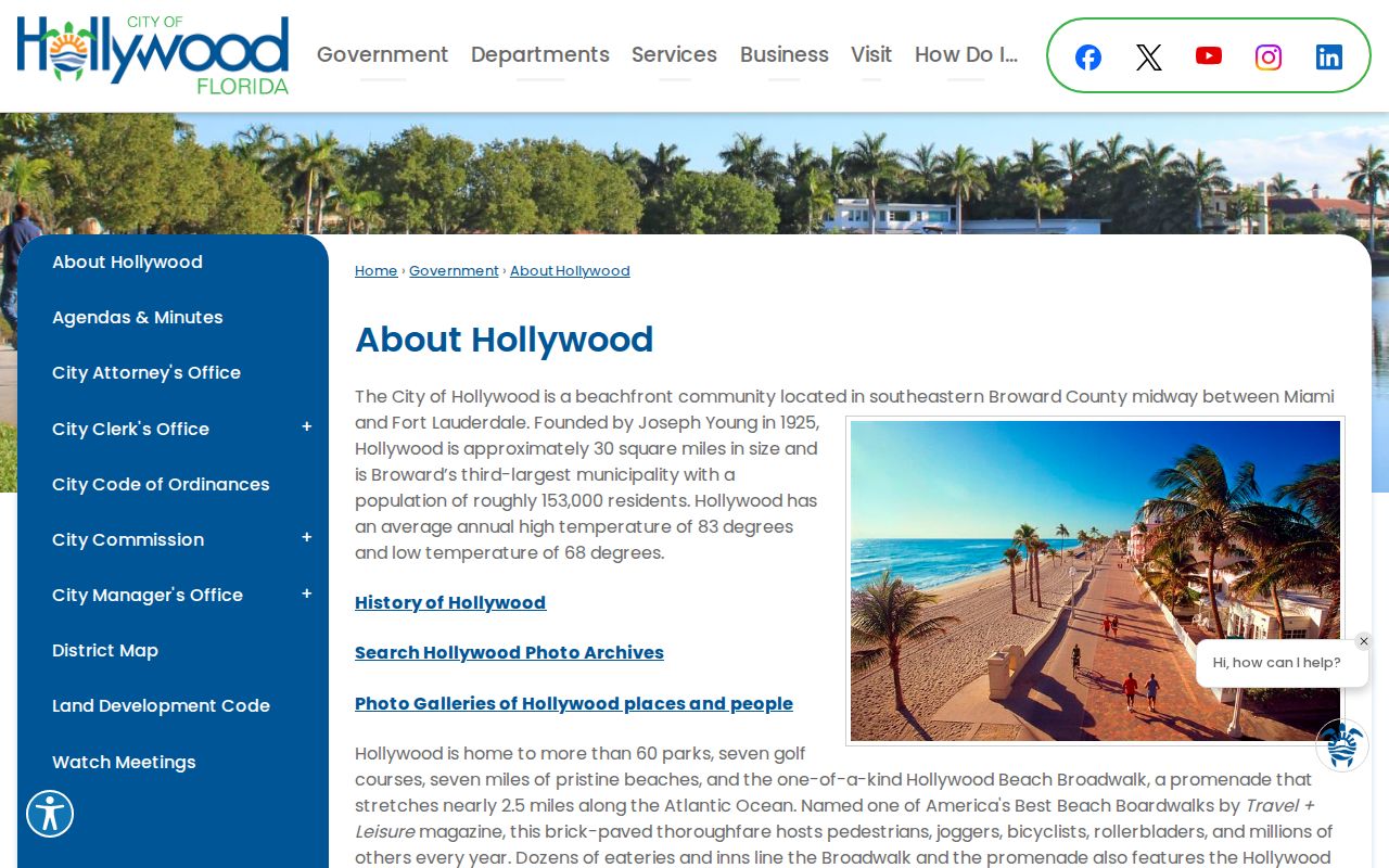
This official context explains why a postal search needs a second jurisdiction check, especially in annexed western areas and at the port.
Broward GIS also publishes address points, annexation history, and historic aerial sets for 1933, 1947, 1955, and years from 1963 through 2000. Those layers can show whether the mapped point, city boundary, and historic development period fit the record being studied. Hollywood Boulevard's 1954 extension west from State Road 7 is another warning: a western address on that road should not be projected backward into an earlier directory without checking the plat and development date.
- ZIP and ZIP+4
- A ZIP identifies a delivery area. The extra four digits narrow delivery to a smaller segment.
- PO-box ZIP
- A code used for post-office boxes rather than a neighborhood of street addresses.
- Unique ZIP
- A code assigned to one large organization or recipient. None was verified here as a Hollywood residential area.
- Carrier route
- A postal delivery path within a ZIP, not a city boundary or resident list.
For records, keep four facts separate: the USPS mailing line, the parcel's situs address, the municipality or taxing district, and the legal description. The situs address is the physical site. The legal description identifies land through plat, lot, block, or another recorded method. A mismatch is a prompt to investigate, not an error by itself.